
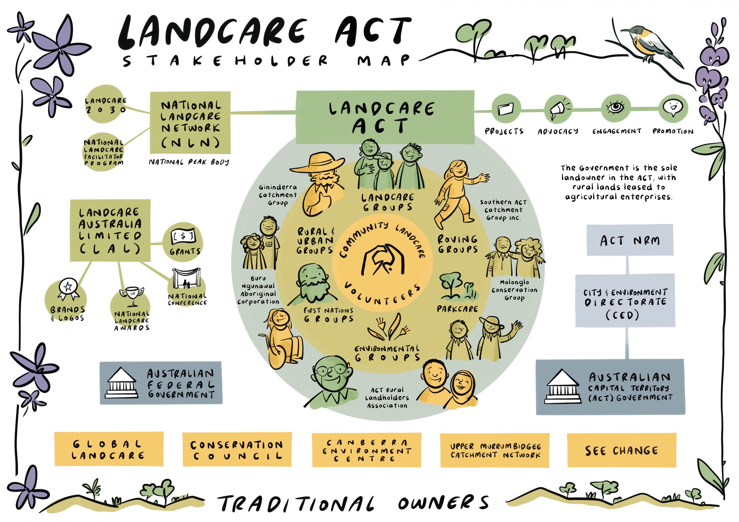
Mapping the Landcare Landscape
Landcare ACT brings together a vibrant mix of member groups, volunteers, government partners, non-profits and businesses —all working together to conserve our ecosystems. But with such a rich and diverse network, it’s not easy to explain how it all fits together.
That’s why we’ve been working alongside the Landcare Facilitator Program to develop something practical, visual and easy to understand: stakeholder maps that help show how Landcare fits together across the country.
These maps were originally designed for Landcare NSW and VIC to support new coordinators and facilitators as part of their induction. But they’ve turned out to be helpful for everyone—policy makers, funders, long-time volunteers, and anyone new to the movement. They give a clear snapshot of how Landcare operates in each region and how different roles contribute to its success.
We envisage our map to help our community understand where they fit, have clearer conversations, build stronger connections, and better explain the depth and reach of the Landcare movement.
Maps for several regions are already complete, including a refreshed and updated map for the ACT. We’re now moving on to the next stage of the project – a national map that will bring everything together.
By telling the story of Landcare in a clear, visual way, hopefully we’re helping more you understand and connect connect with the movement. Together, we’re strengthening relationships, encouraging collaboration, and making sure Landcare continues to grow and thrive across Canberra.


Comments are closed